September 2021: Wind River High Route (WRHR)
Below is our trip report for Adventure Alan’s Wind River High Route (also known as Dixon’s Wind River Range High Route). We relied on Alan’s maps found on his website for the most part, and did his route in its entirety without alternates except one pass near Bonneville/Peak Pass where we followed Andrew Skurka’s high route instead of walking along the shore of Bonneville Lakes. This approximately 80-mile non-technical alpine route travels the crest of the Wind River Range along the continental divide and remains higher than many of the area trails at 10,000 - 12,000’. Approximately 65% of the route is on official trail, but many use trails exist. There is one glacier crossing and a handful of Class 3 moves to circumnavigate lakes.
Day 0
We arrived in Pinedale and met Armstrong (Jay) and Dan Stenziano (our friend we met hiking the Pacific Crest Trail, who makes terrific trail vlogs) after grabbing lunch with them in Salt Lake City, after picking up Matt (our friend from USC) from the airport. We settled into our hotel room and packed up our bags, getting ready for one last fitful night of sleep in relative comfort.

The WRHR crew: Armstrong, Radio, Bites, Matt and Dan - fresh-faced and ready to take on the route.
Day 1
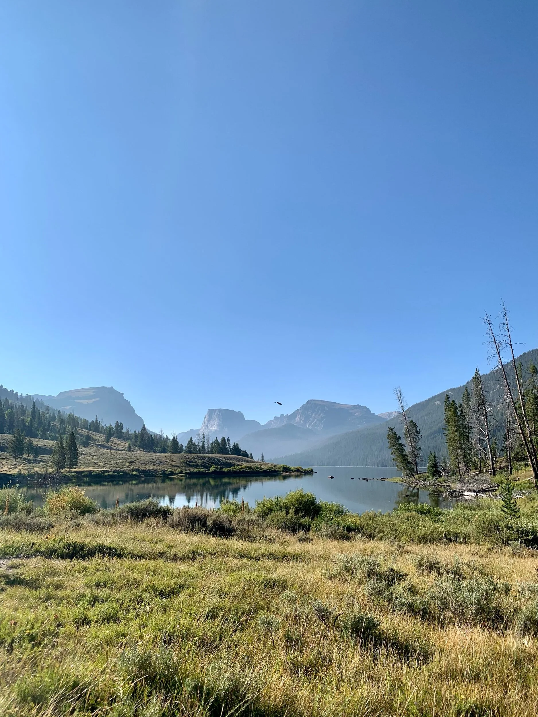
Picturesque trailhead at Lower Green River Valley, our starting point.
We arranged for a shuttle to take us to the Green River Valley trailhead. I get nervous before big trips and the hotel-room brewed black coffee was not helping my stomach as we hurtled up Wyoming mountain roads, admiring big houses and picturesque ranches.

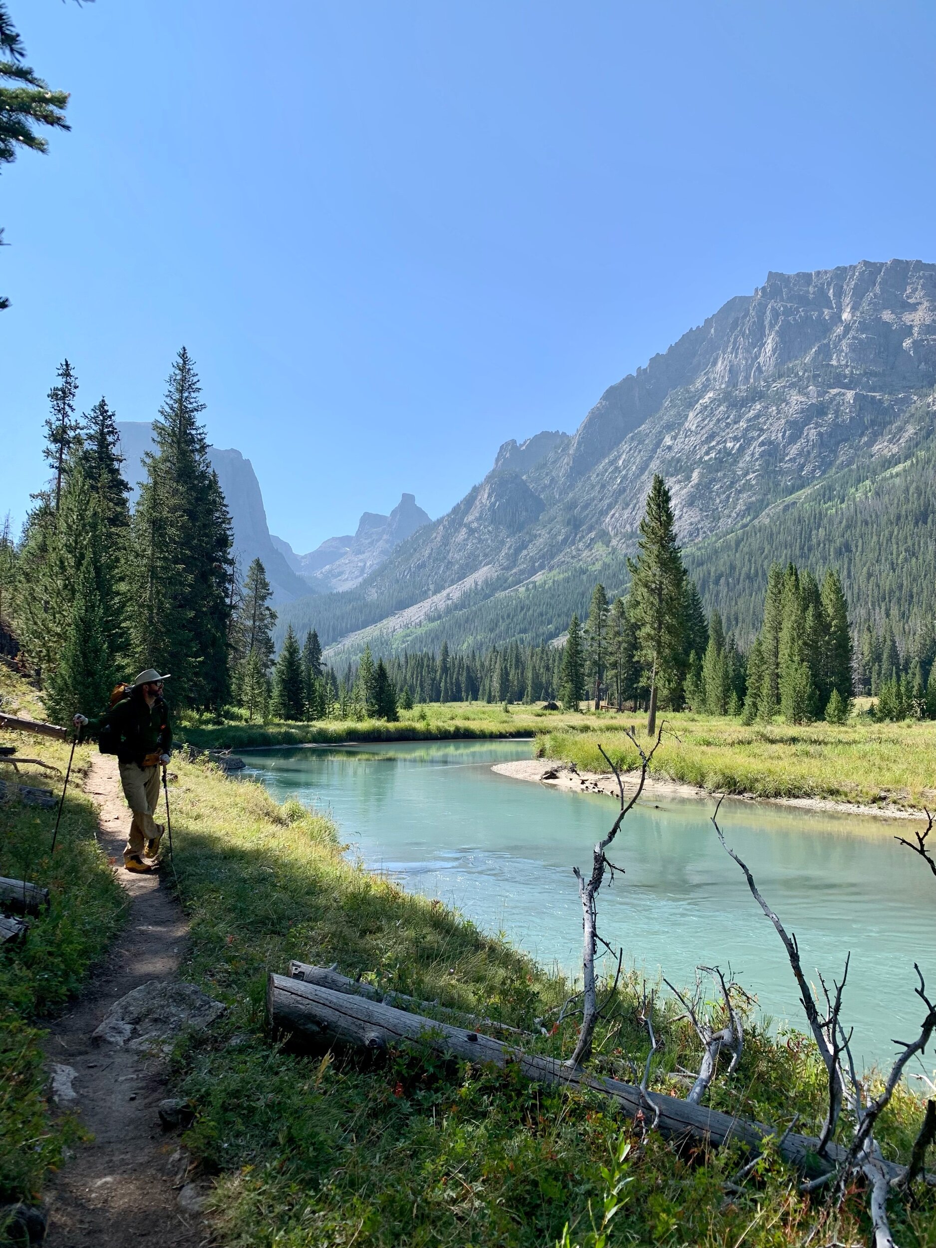
The trailhead at Green River Valley was an easy and gentle hike. We ambled along the green river - strikingly green due to the sediment from the glaciers.
My careful packing was appreciated as my backpack felt relatively light for a 7-day carry (20.3 lbs with consumables). I hiked well and enjoyed talking with the boys.
Armstrong admiring the view of the Green River.
We found a tent site by the green river for lunch before beginning our ascent for the rest of the day, starting with the gentle Vista Pass. We ate dinner in the last bit of direct sunlight found in the bowl below Cube Pass, which we hiked after dinner. Radio and I split a Backpackers Pantry Pad Thai dinner which was great but gave me significant heartburn as we climbed up the pass.


Matt hiking to our dinner spot on Day 1, below Cube Pass.
Looking back over Cube Pass.
We found a tent site at Peak Lake at the end of the day, settling into a gorgeous alpine glow. We grouped our Ursacks together in our “Christmas Tree” so that the bears would try to get our food there instead of from our tents.


Day 2


We woke up at Peak Lake and started the route along the east side of the lake, crossing the outlet. There was a use trail that climbed up some talus and then descended down to the lakes shore. My scrambling legs were still new to the trip and the loose dirt on the descent spooked me a bit.


Our first pass today was Knapsack Col, which appeared to be rather infamous. I found it to be fine, and we hiked up without much snow at all. Armstrong helped me gain some confidence with the descent down loose dirt and talus which was greatly appreciated. My Scarpa approach shoes also gave me a bit of confidence on the boulder hopping at the expense of on-trail comfort.

Dan on Knapsack Col.
The descent into Titcomb Lakes Basin was beautiful, and we could easily see why it was one of the most popular basins in the Wind River Range.

Titcomb Basin

Sandy shores of the lakes in the basin.

We stuck our toes in the lake, even though it was still very cold, and hiked up to Indian Pass Basin where we camped at another beautiful lake. The scenery today was absolutely some of my favorite.
Day 3

Our campsite view from the second night.
We started our day climbing up Indian Pass, where we began by navigating a gorgeous meadow basin (usually snow-covered).

Top of Indian Pass.
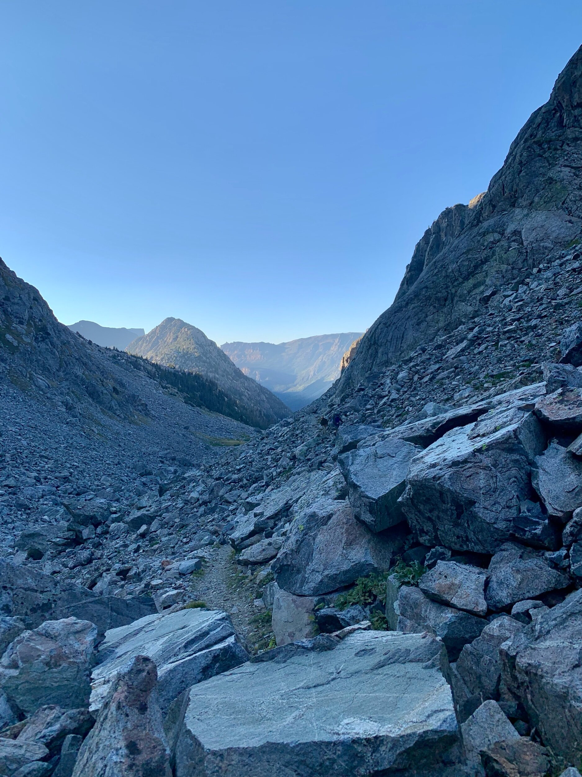
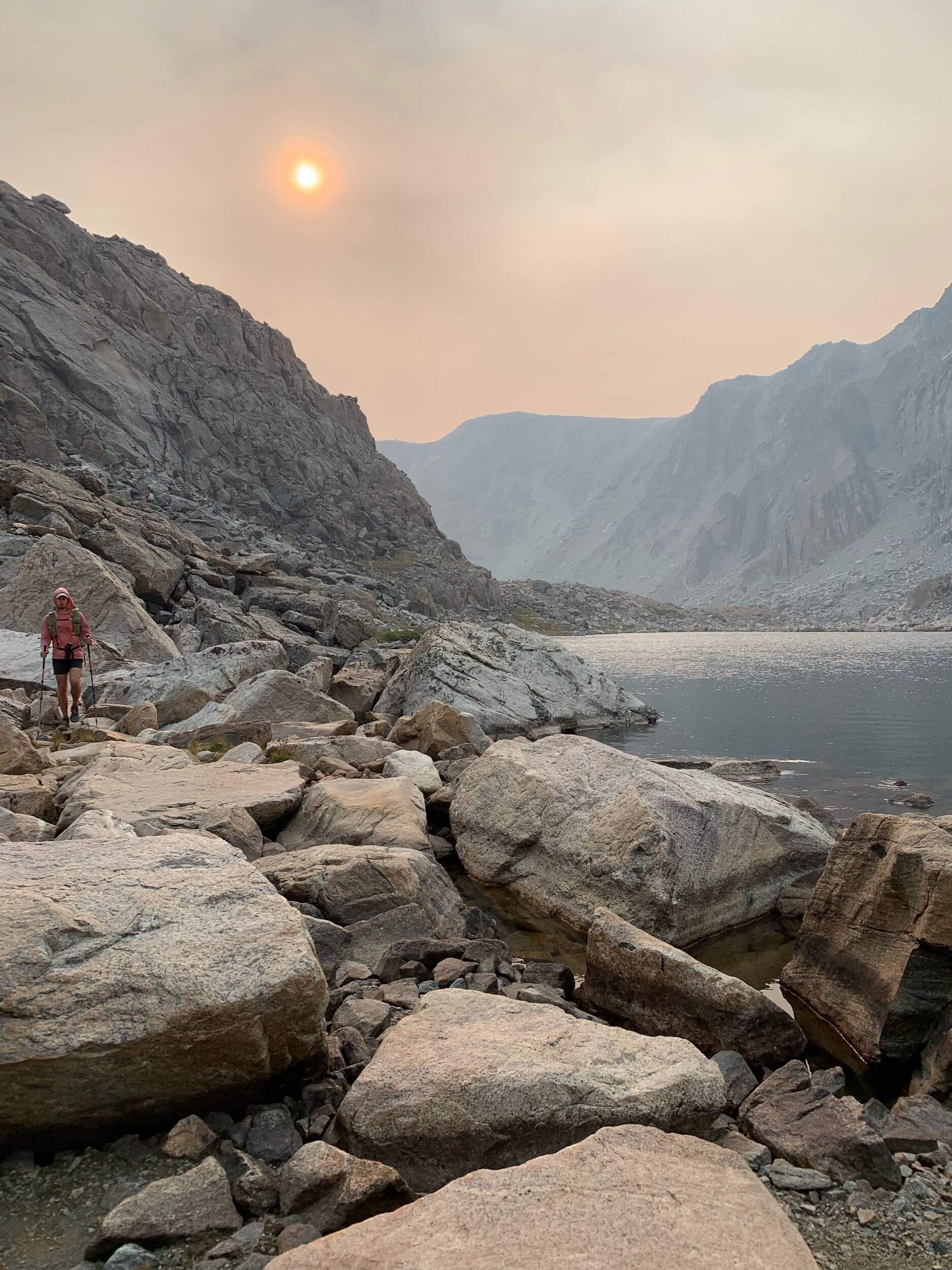
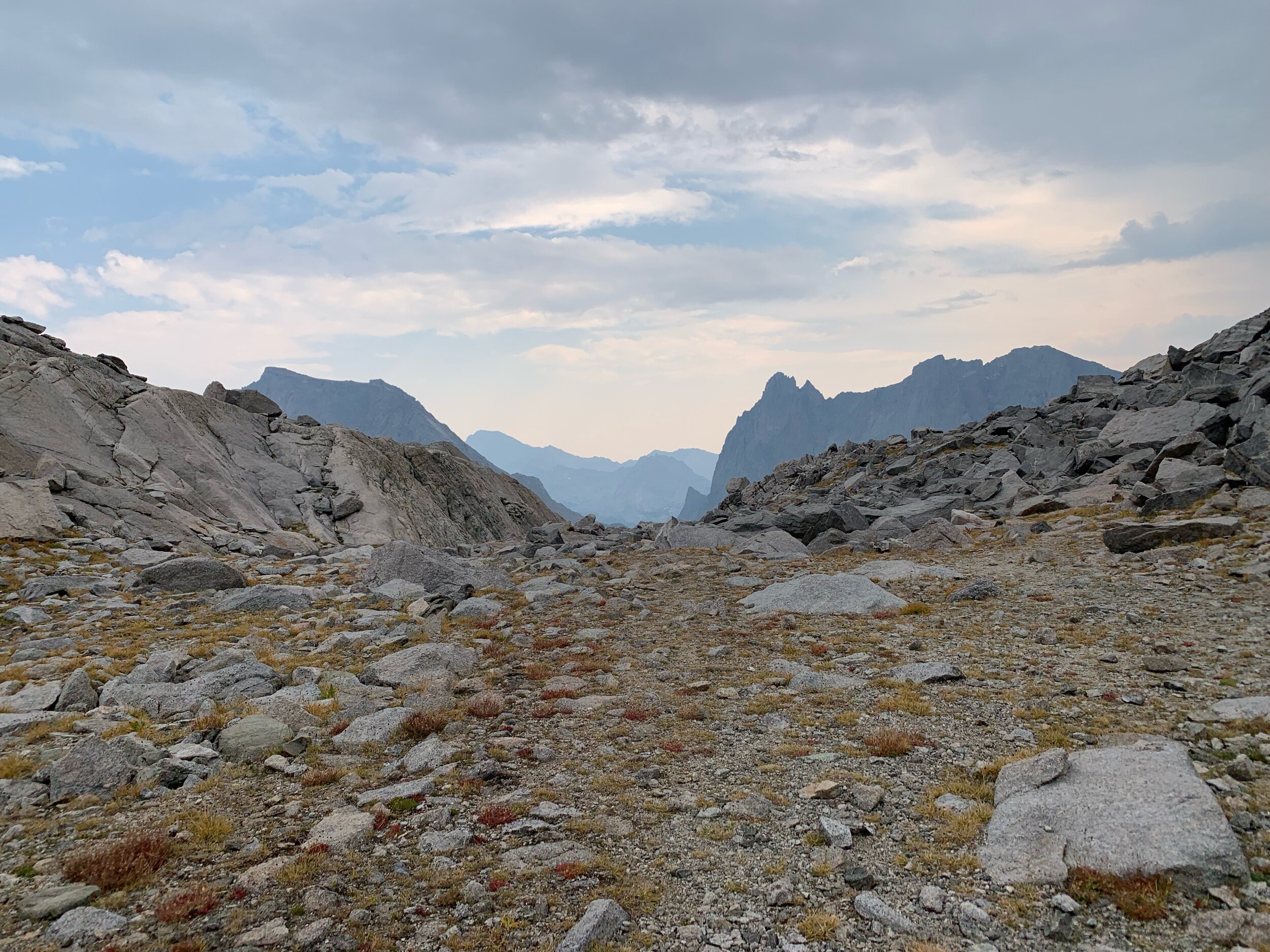
Today was one of the most technically challenging days due to the two large passes and crossing of Knife Point Glacier, on the other side of Indian Pass. Consistent with the rest of our trip, the pass was dry and when we crested, we couldn’t see the glacier at all.

This photo shows how steep and loose the descent was!
However as we began our descent, the glacier came into view. Crossing the glacier would make for faster travel (and give us a reason for carrying our microspikes on this dry trip) over the slow going talus.

Matt and I admiring our microspikes while Armstrong tests out the glacier.
We put on our microspikes and crossed the glacier carefully. There were a few rivers of glacier water running through that were beautiful (and delicious), but overall the crossing was uneventful.

Getting over the next pass was slightly more difficult as we navigated the lateral moraine the glacier left behind - a mix of ground up granite, talus of varying sizes and frozen mud. This unstable mixture is what the glacier leaves behind as it moves and it made for slow travel as we tested every rock we stepped on.
Eventually the pass turned into the cardio stair-stepper on lose dirt every pass seems to turn into, before we reached the top.

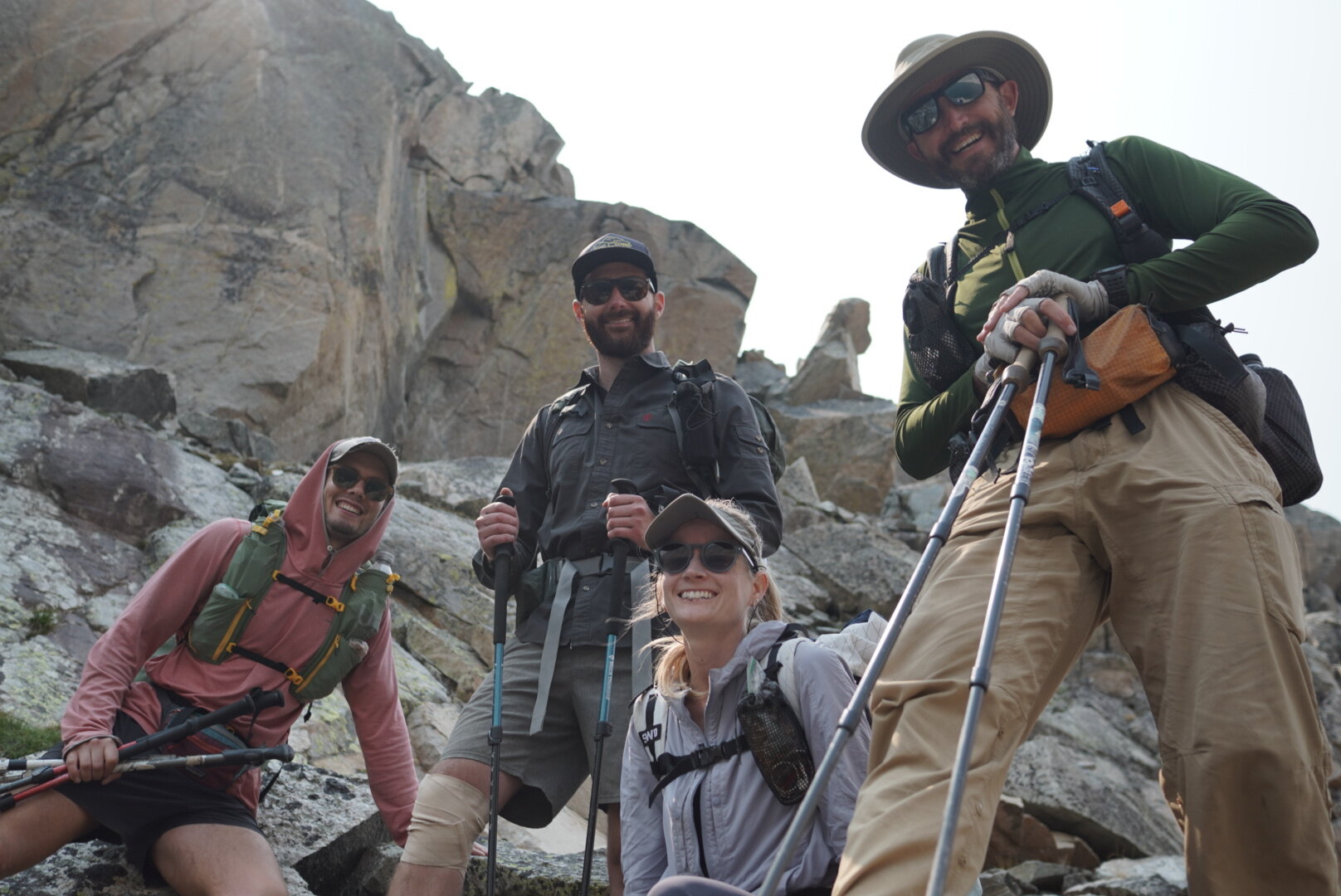
A very happy crew after getting past Knife Point.
The descent was more of the same, and the route the rest of the day took us along several lakes. Without a trail the travel was slow but satisfying, and the lakes were beautiful.


Cross-country around a couple of lakes.


The capstone of our technically difficult day was a Class 4 exit crack along the south outlet of the final lake we were following. Nestled above a line of scrawny pine trees was the crack, which was fine and more of a Class 3 crack. We climbed up and then descended down some granite ramps (where we took dinner) to the next lake, Camp Lake, which ironically had less than ideal camping in the trees. The smoke from the wildfires also came back after our first two bluebird days.
Day 4
Today we traveled from Camp Lake to an unnamed lake at 10,806’.
There weren’t any crazy passes today, just a lot of off-trail route finding and a gorgeous, long cool section of highlands that felt like the English countryside.
We picked our route around a couple of lakes until we found camp.
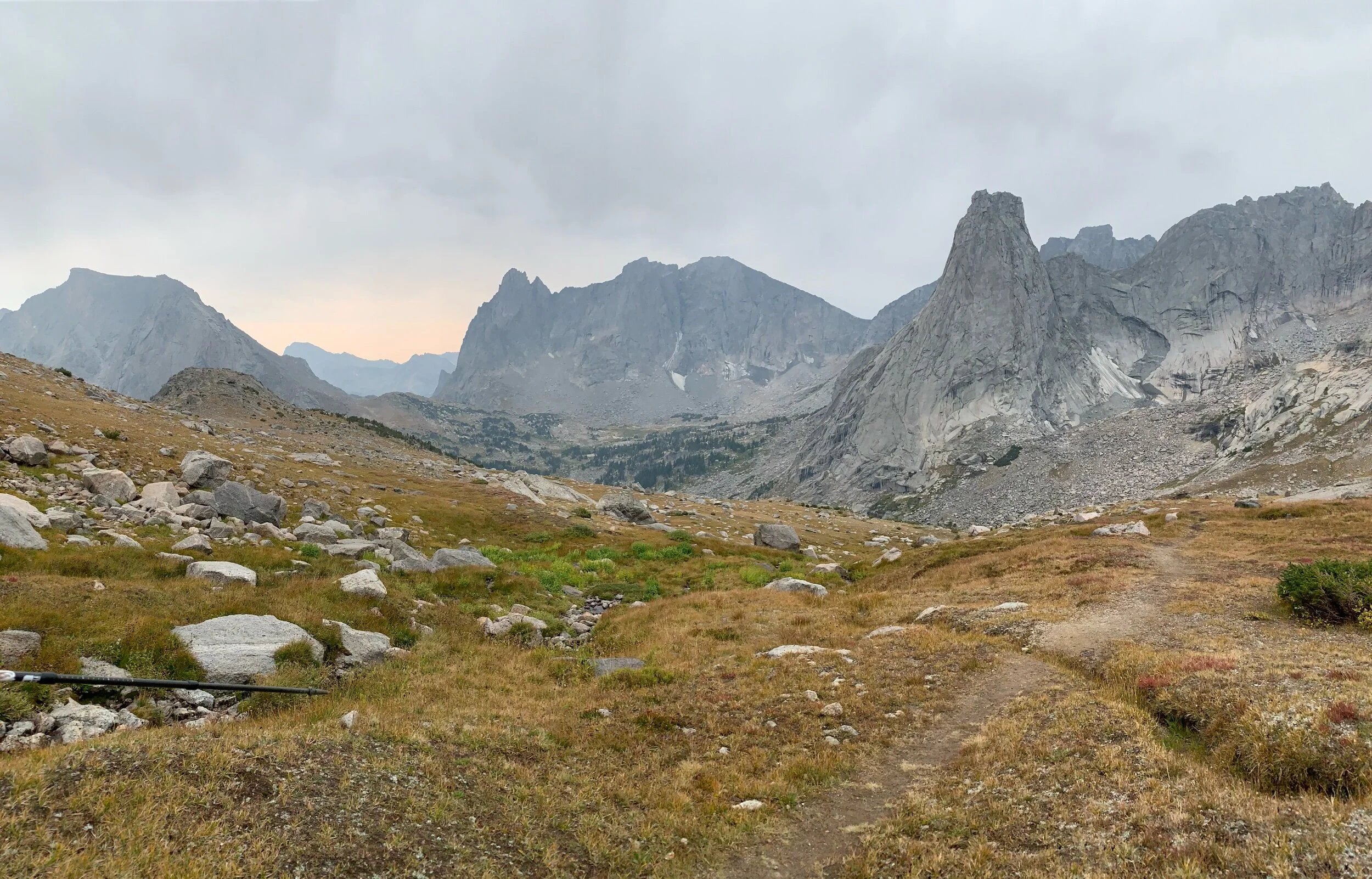
Day 5

This morning consisted of lots of route finding along lakes and valleys. We had a smaller pass early in the morning and then a slightly larger one expected.


Today was Wednesday, which means the first day that thunderstorms were expected in the afternoon - not unreasonable for our location and time of year. We did need to make good time to account for potentially hunkering down for a few hours in our tents, and ideally not while climbing one of the bigger passes.

We had lunch at the aptly named Pronghorn Peak.
When we got over the first pass, instead of descending into the valley and going around a lake to take a different pass to the same basin, we took Skurka’s route directly over the pass to save time.
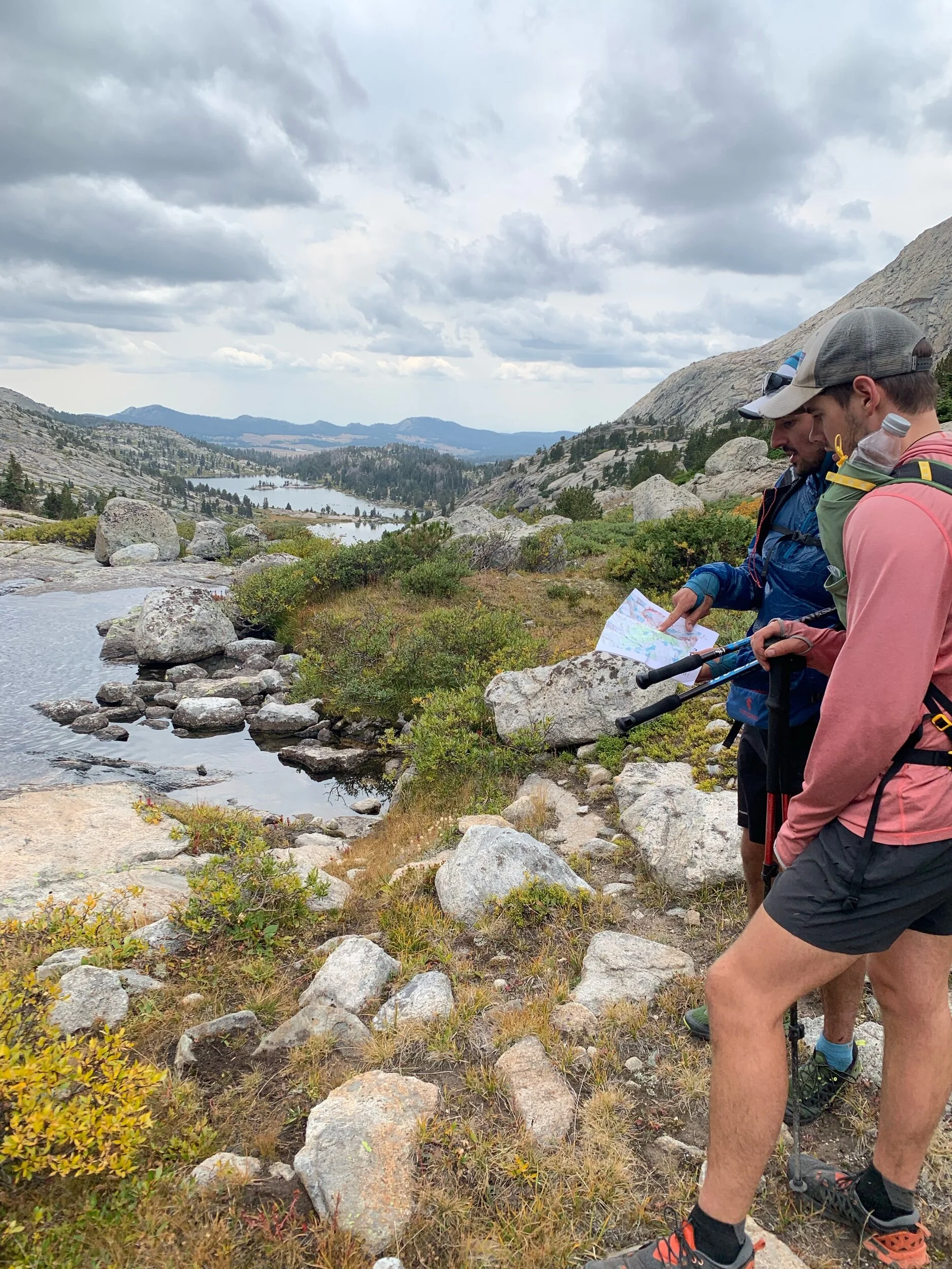
Debating which route to take here at the outlet of Bonneville (Jim Harrower) Lake.
There were some Class 3 moves on this pass and I had to take my pack off a few times, but overall it was uneventful. I ended up taking a simpler, talus hopping route to the pass while some of the boys continued on the granite slab.
When we got to the top of the pass we were greeted with seemingly endless talus and a beautiful view. We descended onto a bench with a lake where we planned to either stop for dinner or for the night. Dan and I lingered behind taking photos of the moody atmosphere while the rest of the group decided we needed to pitch our tents for dinner now, to avoid the coming thunderstorm. As soon as we got the pitch up, marble-sized hail started coming down. We had gotten our tent up and Dan’s tent - and soon we all huddled together under our larger tent. I heated up some dinner and used our Garmin to text my dad for a hotel room the night we planned to arrive in Pinedale.


The bench with the lake where we camped, pre-hailstorm.
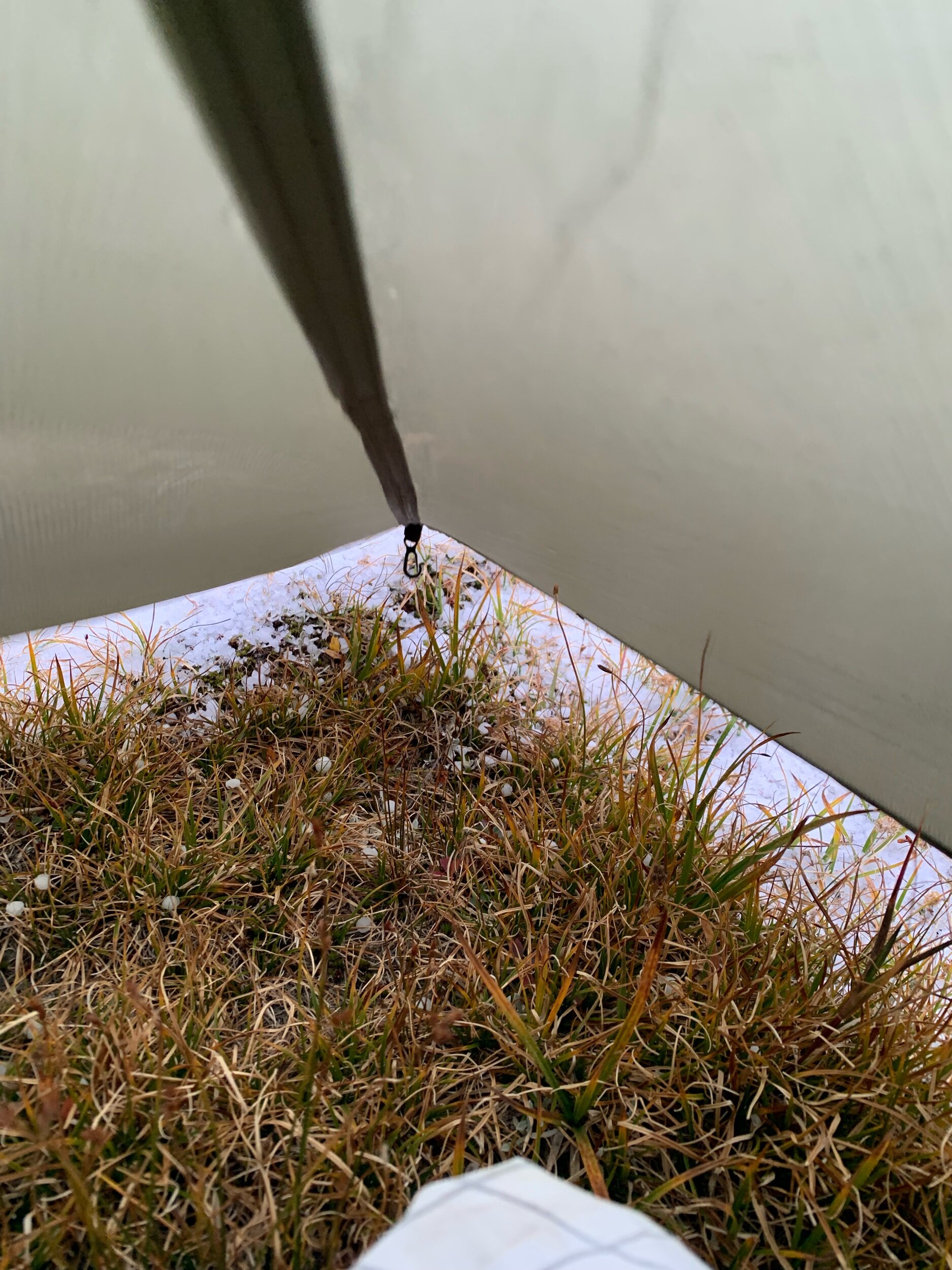
Hail from the outside of our tent.
The hail eventually let up and everyone else pitched their tents and we settled into a cold night.

Day 6
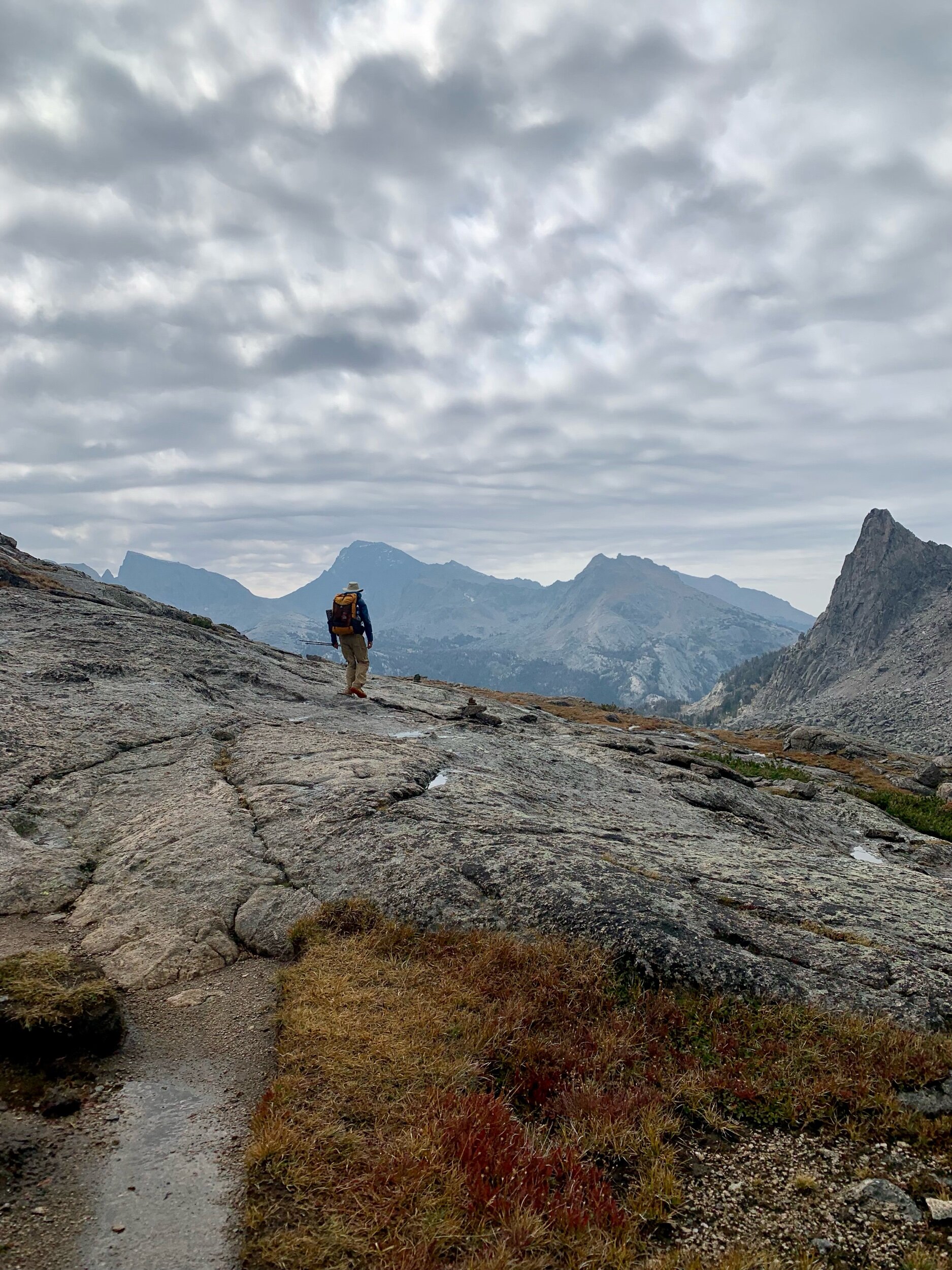
We woke up to a very cold but beautiful morning and walked down to Pyramid Lake, making our own route through bushes and granite.

The boys bagged Midsummer Peak while Matt and I continued along the trail that began at Pyramid Lake down to Skull Lake where we waited for them to rejoin us.
There were a couple more day hikers out enjoying the beginning of Labor Day weekend.
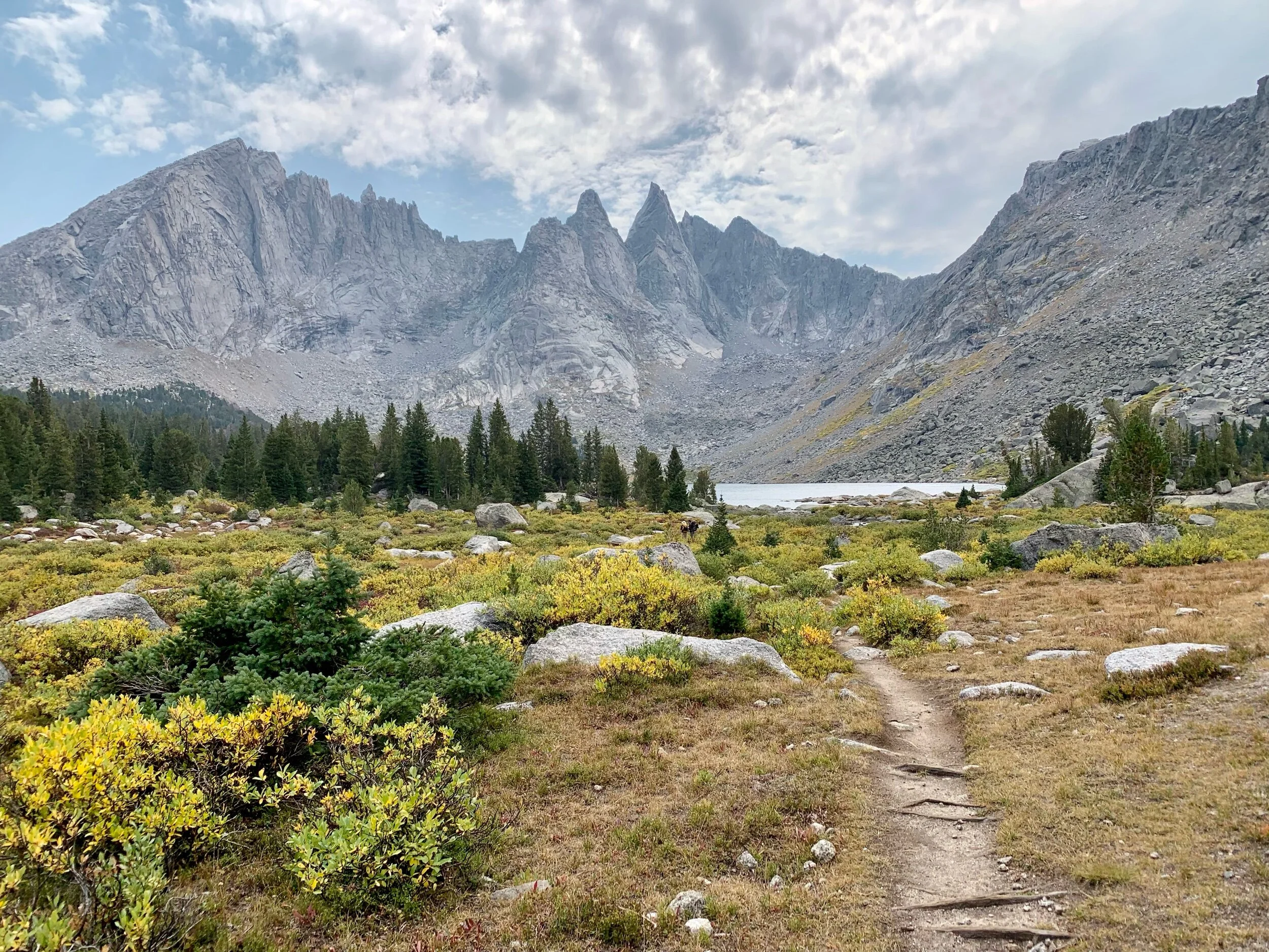
The Cirque towering above us made for a beautiful day, and soon we got to Texas Pass. The clouds in the sky were getting darker and even though Texas Pass was a simple pass with a use trail through the talus, I was anxious about the weather and encountering a thunderstorm at the top of the pass. Being extremely cautious given our experience the night before, we pitched our tents quickly at the sight of a few raindrops. However, soon the clouds began to clear. While we would have been okay waiting out the rest of the day there, I decided to start making my way up the pass. I hadn’t gotten past the meadow on the other use of the lake when it started hauling again. We set up our tents, and just as quickly as it started, the hail stopped. I decided to keep hiking up the pass and we were over it quickly.

Cirque of the Towers and fall colors.
On the way down it started to rain, and we had a significant descent into Lonesome Lake. Dan and Armstrong had gone ahead to scout out campsites by the lake and we joined them in a hideout above the pine trees were we set up camp.

Lonesome Lake
It rained hard and I willed the puddles to not flow under our single walled sil-nylon tent. Eventually the rain slowed (through the drops from the pine tree we camped under did not stop at all) and I emerged to watch Dan put the finishing touches on a nice fire - something we can’t do in California. It was nice to warm up and have something to distract ourselves from the gloomy night.

Eventually we went back into our tent where it felt like it rained all night. The drops from the pine tree shook free the condensation on the inside of our tent making for a damp night.
Day 7
In the morning the rain was still falling, but we had only 9 miles separating us from a hot shower and a hotel room.
We scheduled our pickup for 3pm, but the original goal was to bag Camel Peak or just spend the day at different lakes, but with the weather we just tucked ourselves back into our quilts until the sun peaked out around 9:30 in the morning.


Jackass Pass was straightforward (despite accidentally following Skurka’s route also known as the Climbers Trail for a quarter mile extra descent) and we navigated the wet trail (at some times a creek) to North Lake and then Big Sandy Lake, where we powered out the last 5 miles on trail to our shuttle pick up. Given the holiday weekend, the trail was busy with weekenders and lots of dogs.

Big Sandy trailhead was not quite as picturesque as Green River Valley, but we were focused on getting to town!